
About Us
Geodesy connects you to your data, spatially.
We offer GIS consulting, system configuration, integration, automation and support, along with a suite of ready-to-use apps. Our clients range from cities and counties to federal agencies, and from small to large engineering firms.
It can be challenging to organize and maintain enterprise data, and to provide that data to the people who need it in a form that answers their questions. Organizing data spatially, and presenting that data on maps and in self-service applications can make it accessible to a broad audience.
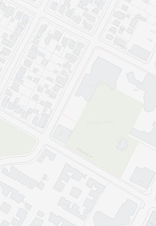
Geodesy has a wealth of experience creating 2D and 3D desktop and online mapping applications to communicate and relate complex data such as roads, addresses, parcels, buildings, utilities, floor plans, space utilization, census, transit, hazards, and 9-1-1 emergency response.
Why choose us?
- At Geodesy, our clients come first, which leads to long term success stories and enduring relationships.
- Combining relational and spatial data is in our DNA. We know how to keep it simple and make it work.
- We are problem solvers and thrive on tough challenges, from inter-system to inter-departmental to inter-jurisdictional.
- We also see the big advantage of solving small problems.
- We work closely with users, managers, and directors to ensure our solutions are successful across the organization.
- We understand and support the benefits of task-oriented automation. Understanding business processes and applying some automation can increase efficiency, consistency, and accuracy.
Services
Geodesy's services range from consulting to application development.
Consulting
Geodesy provides GIS needs analysis down to the data modeling level. We use dictionary tools to catalog and analyze GIS data and determine if data should be organized centrally, distributed, and/or replicated. Application needs are identified and appropriate combinations of off-the-shelf, configured, and customized software recommended – always balancing initial cost with long term savings.
Implementation
We have years of experience successfully configuring, tailoring, and deploying GIS to meet enterprise needs. Geodesy has implemented systems from light, easy to use, inexpensive starter systems that invite broad and varied GIS use, to expert-oriented solutions that support planning, land records, utilities management, and emergency response. Our clients' GIS often serve hundreds of enterprise users, and many more online.
Integration
Geodesy's systems integration solutions are enterprise-oriented and often GIS-centric. We use an integration model that directly links or exchanges data between systems in batch or near real time. The model respects the data maintenance life cycle, accommodates data silos, is fault tolerant, and tracks and reports exceptions.
Automation
Our automation spans from server-side routines that smooth back-office operations to task-oriented user interfaces that ease and focus GIS use. We specialize in data-driven applications, using configuration settings to determine application content and scope, allowing applications to meet needs as data sets grow and change.
Platforms
Geodesy combines mapping technologies with well organized databases of spatial and related data by integrating, configuring, and automating systems to meet client needs.
Mapping
Our clients often use some combination of Esri's ArcGIS and Geodesy's Encompass tools. Google Maps, Openlayers, Leaflet and other free and open mapping technologies are also employed by Geodesy when appropriate.
Database
Well organized data accessible across the enterprise is the backbone of GIS. Most implementations use a relational database like SQL Server, MySQL, Azure SQL, Oracle, Postgres, or Access and SQLite on the lighter side.
Automation
Geodesy integrates and extends GIS capabilities, making routine tasks faster and easier, using JavaScript, C#, Java, PHP, and Python. These days, we often create and consume REST APIs using these tools.
Close the Gap
GIS shouldn't be on-the-shelf software.
When well implemented, GIS decreases workload and increases engagement.
Task-Oriented Applications
Geodesy specializes in applications that bring GIS to the user and their specific use cases. We configure and create applications that tailor their scope and design to user needs. This decreases the need for GIS expertise and training, increases GIS adoption and user autonomy, and puts more eyes and hands on GIS. Geodesy has written task-oriented applications in an agile style since the early days of Encompass, and has brought that philosophy and benefit forward to modern web apps.
Open Data
Open data allows users to build their own maps and do their own analysis. Long before the powerful ArcGIS Online feature services and ArcGIS Hub platform, Geodesy helped clients organize and distribute data via shapefile, dxf, and other formats. With the advent of Google Fusion Tables, Geodesy created Gedit to allow users to easily present and focus open data use on web maps. With ArcGIS Online, REST API, and Hub now firmly in play, Geodesy's offerings go deeper and farther.
Featured Projects
Encompass Web App
Your maps and tools organized online
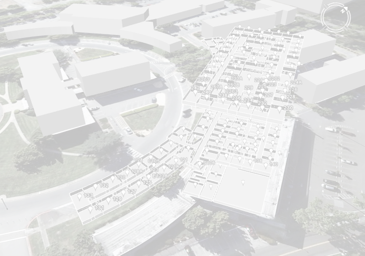
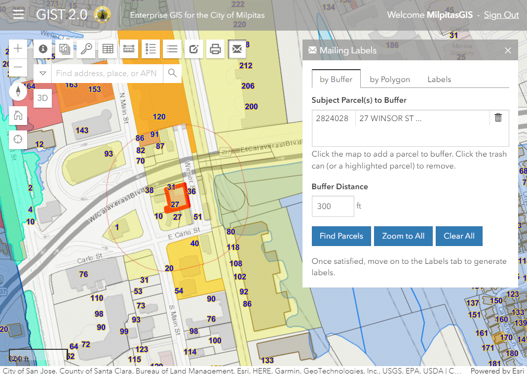
Geodesy is bringing its long-lived Encompass enterprise desktop applications to the browser with the Encompass web app. The web app provides one-stop GIS map, data, and analytics access to local government staff and the public. Like it's desktop ancestors, the Encompass web app is built for daily use by people who may have little or no GIS training. It packages the GIS functionality that the majority of people need on a regular basis. By distributing GIS use broadly across an organization, Encompass significantly reduces the load on GIS experts and their expert-friendly applications.
The Encompass web app includes an intuitive map manager, along with specialized yet still easy to use widgets like Mailing Labels and a tabular data editor. It integrates with other agency applications such as asset and permit management systems. It includes the simple yet powerful Dox spatially indexed document management system (more below). The app gets its GIS data from ArcGIS Online and/or ArcGIS Enterprise and non-Esri databases. The application administrator controls the access to maps and widgets on a by-group or by-user basis.
The Encompass web app is built using Esri's open ArcGIS JavaScript and REST APIs. This high and performant development platform gives the application integrated 2D and 3D capabilities while allowing it to include Esri and non-Esri functionality and data.
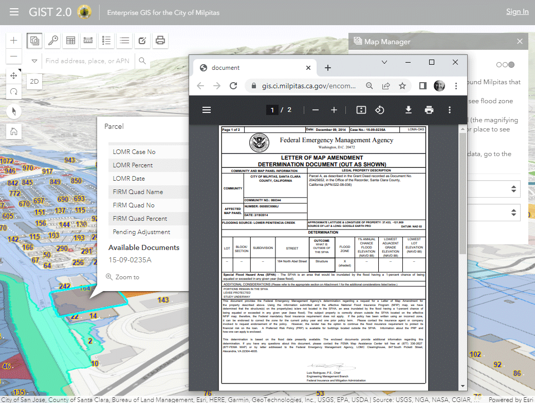
Dox
Spatially Indexed Related Documents
Dox was originally created in 2006 by Geodesy for the City of Palo Alto as an interim replacement for an aging document management system. It opened up the file storage system to simple files in Windows folders (like PDF and JPG files) and organized those files for spatial access from Encompass and other GIS applications. While replacement document management systems were evaluated by the city, none were as simple, open, flexible, and affordable as Dox. The system is still in use at Palo Alto along with a number of other GIS sites.
Dox can store and provide GIS access to any number of documents, counted in terabytes for some sites. The documents can be stored in folders on a in-house (on-premises) server, on a web file server, or now on an Amazon Web Services (AWS) server. The documents are accessible from desktop and web applications, including the new Encompass web app (see above). Dox is available from Geodesy with Encompass or stand-alone.
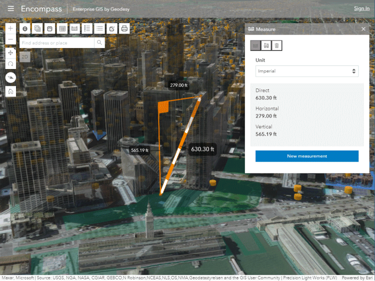
3D Maps in your Browser
Geodesy has been enjoying a recent resurgence of 3D in GIS. Esri has taken over where Google Earth left off and brought wide-area 3D mapping and analytics to the browser.
Most recently, Geodesy has been working with Fastcast and Prevision Design to support Housing Element city planning. Geodesy applies GIS to present 2D housing data as a city-wide 3D bar graph of possible scenarios in the context of 3D building models over the terrain of a city, all through interactive web apps.
Geodesy employs Esri's ArcGIS Pro, ArcGIS Online, and ArcGIS JavaScript and REST APIs behind the scenes to construct the interactive 3D maps. The team can source building models and generate city-wide shadow and nighttime luminance studies.
This is an exciting example of how complex spatial data and analysis can be intuitively presented to an audience interactively on their own devices (even phones) so they can understand and evaluate options for future development.
To top it off, 3D maps and analytics can be included in the Encompass web app to make them easy to find and use. This allows the features on the maps (like the 3D buildings) to be linked to related documents via Dox (see above).
More Projects
Here are more examples from our long list of project experience.
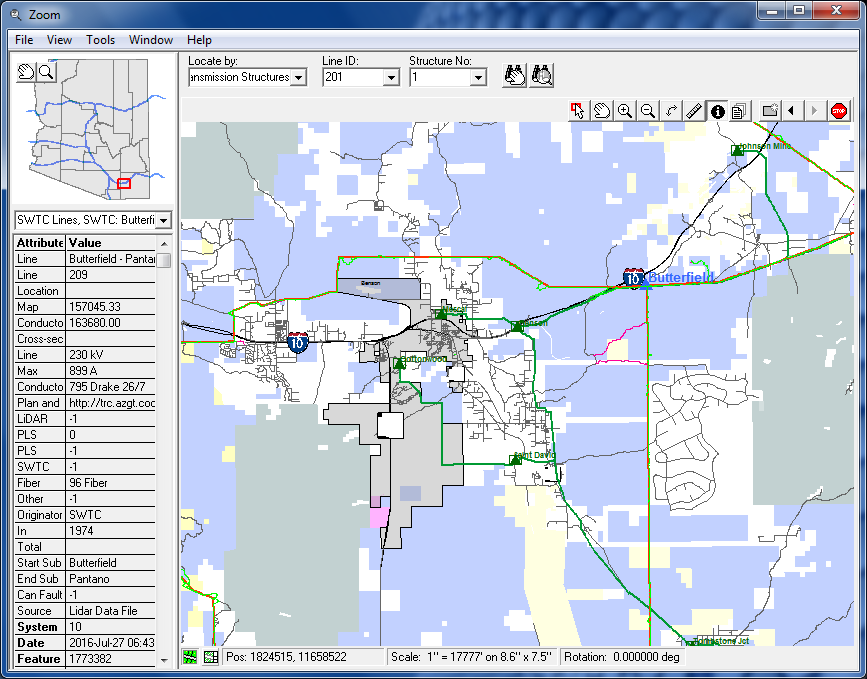
Enterprise GIS
Geodesy has successfully implemented Enterprise GIS for Palo Alto, Wake County, Cochise County, Kenai, Milpitas, and others.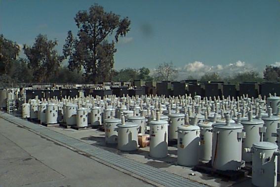
Asset Management
Many of our clients use GIS primarily for asset management - from space utilization to utility infrastructure.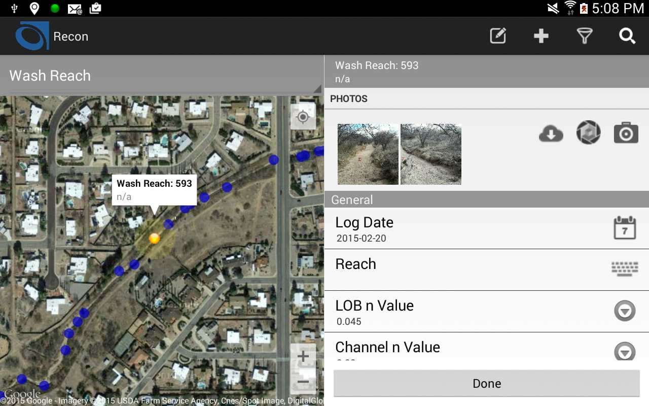
Mobile GIS
Geodesy has mobile GIS solutions to fit field use cases. They can work on- and off-line and are highly configurable.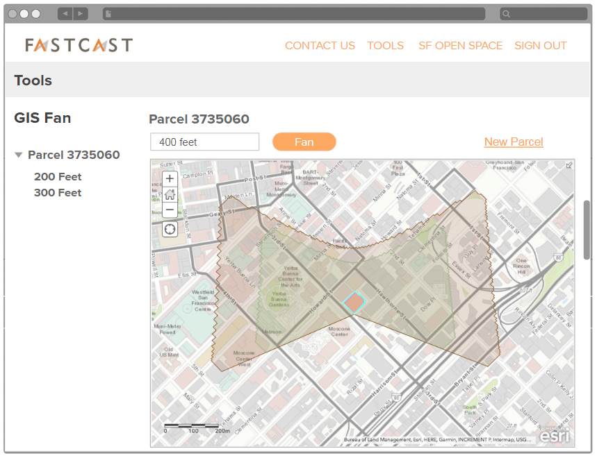
ArcGIS Online Apps
We apply ArcGIS Online web mapping to specific use cases like shadow study presentations for Fastcast.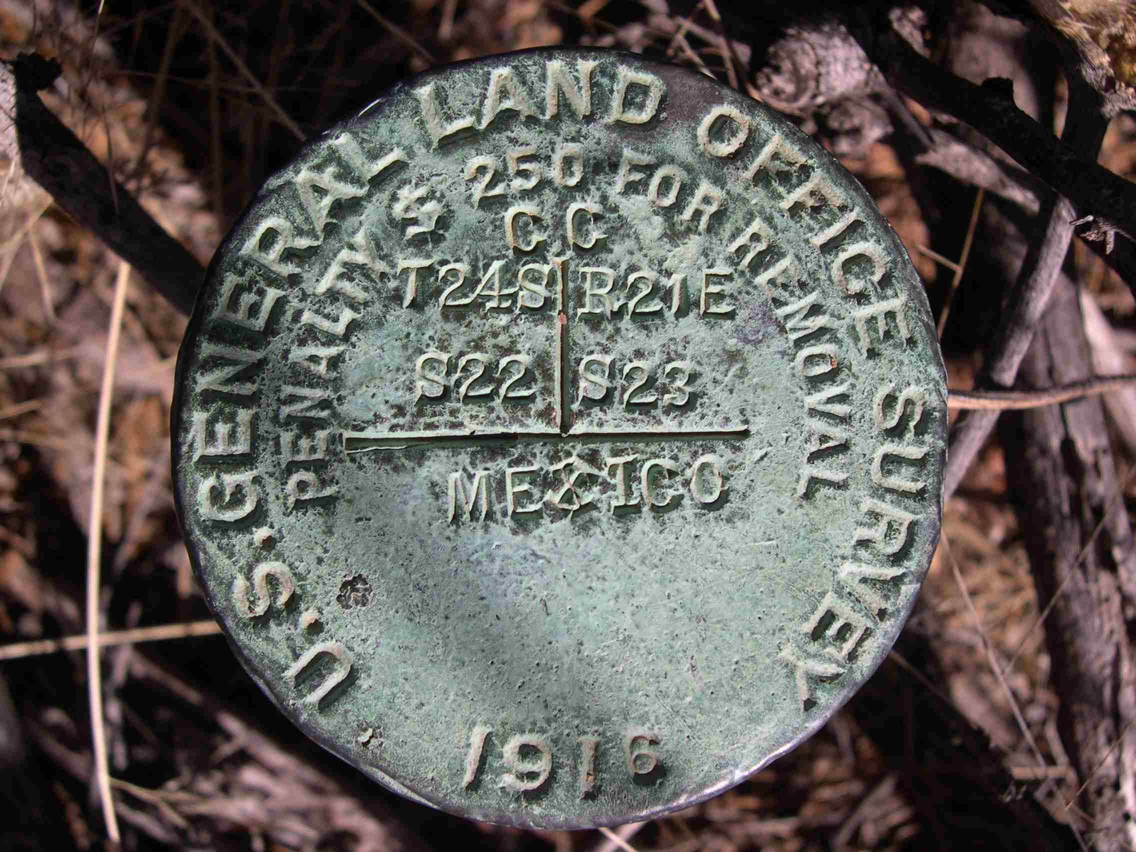
Survey Accuracy
Geodesy supports and advocates the concept of GIS as a system of record, tying layers (typically parcels first) back to ground control points.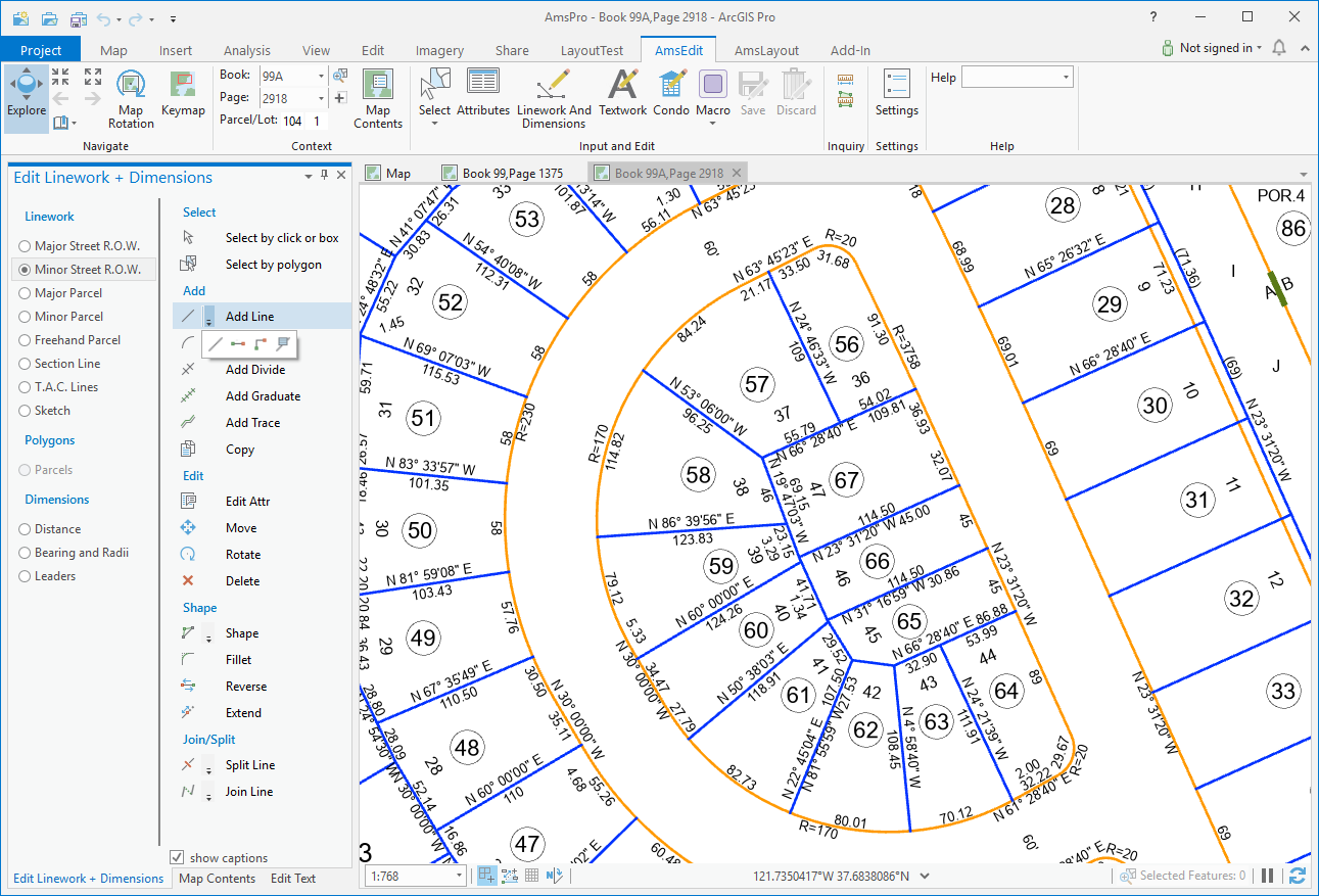
ArcGIS Pro Add-Ins
ArcGIS Pro is Esri's flagship desktop product, and Geodesy's task-oriented Add-Ins can make it easier and faster to adopt and use.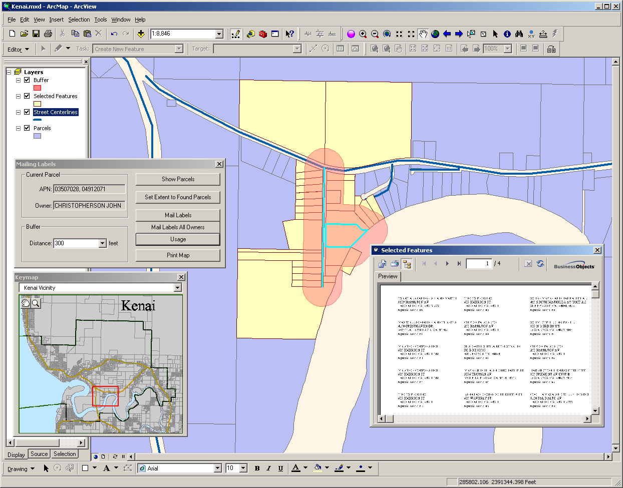
ArcMap Add-Ins
Esri's ArcMap predates ArcPro and Geodesy provides Encompass Add-Ins to support its use as well.
Strategic Planning
We provide consulting services starting at the strategic planning level and delving down to data cataloging and organization.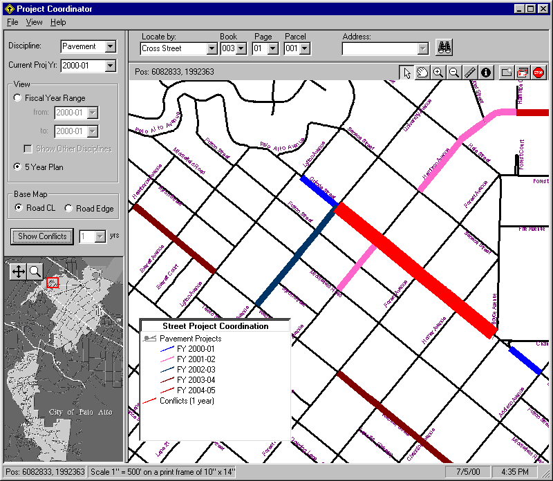
Project Coordination
Project Coordinator is a task-specific Encompass app used to manage underground utility activity to help minimize street closures and repaving.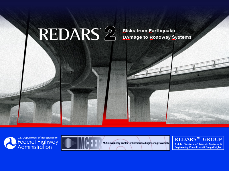
Risk Management
REDARS used GIS to help FHWA and DOTs reduce the economic impact to regions due to earthquake damage to roadway systems.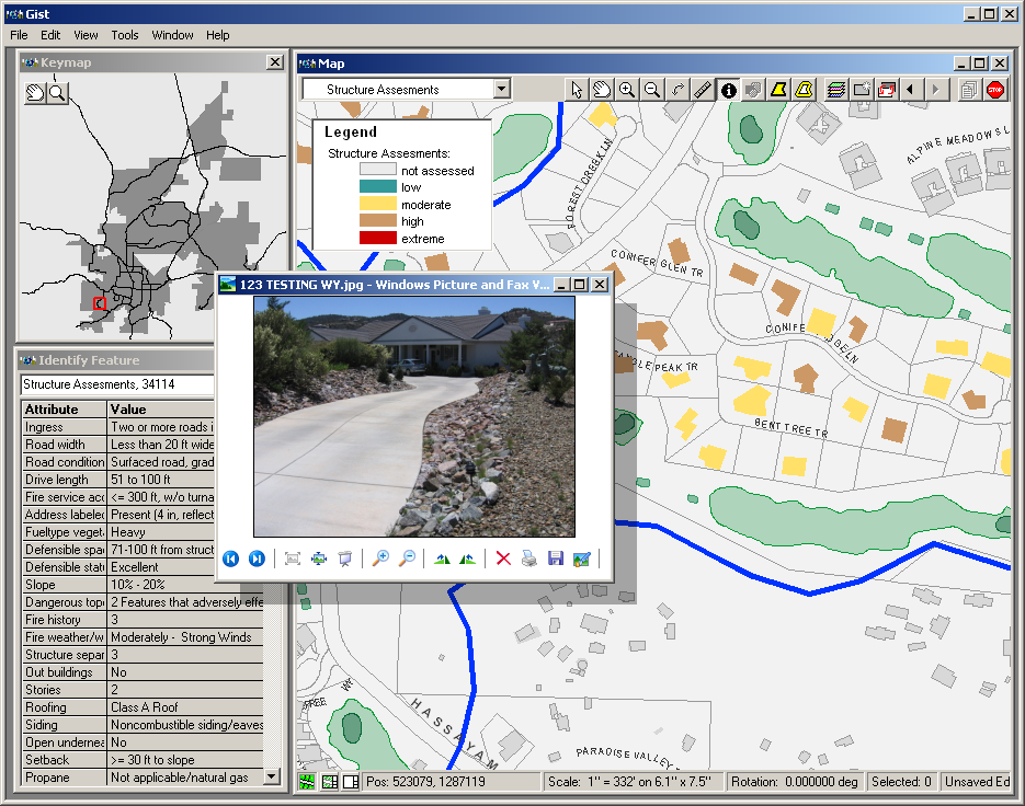
Fire Risk Assessment
We configured Gist, an Encompass enterprise app, to allow Prescott to collect, analyze, and present fire risk data.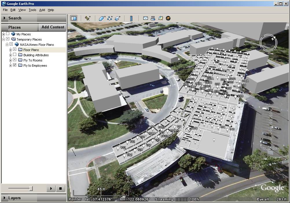
NASA Ames 3D Model
As architects by training, Geodesy's founders enjoy expanding GIS into the 3rd and 4th dimension.
Metro GIS
Geodesy worked with Four Nines to catalog and analyze St Louis Metro's GIS data using our metadata-based tools.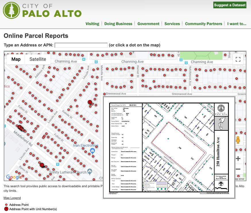
Parcel Reports
We significantly reduced the staff time required to provide parcel information to the public via online parcel reports for Palo Alto, Cochise County, and others.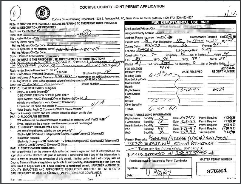
Related Documents
Geodesy employs a simple file-based management method called Dox to allow terrabytes of documents to be accessed via maps.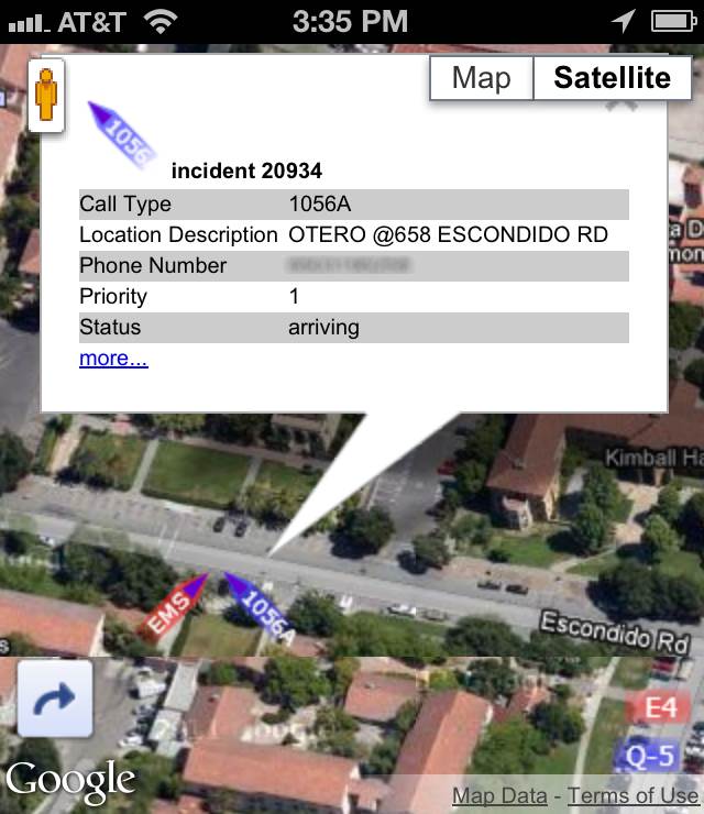
Emergency Response
Geodesy created a mobile app for Palo Alto emergency dispatch showing incident and responder locations in real time.Clients


Modernize your GIS
Join Geodesy in moving GIS into the cloud and out to the people who need it.
- Take advantage of low cost online data and tooling through REST and JavaScript APIs.
- Tap into the growing collection of free spatial data that surrounds you.
- Decrease your IT infrastructure and administration using cloud services and online mapping.
- Close the gap by getting your data and message to the people who need it using 2D and 3D maps.